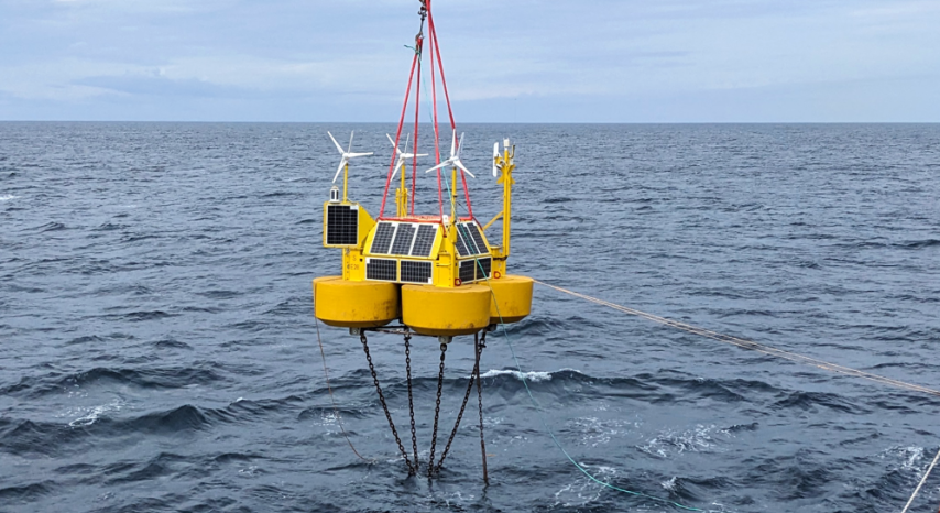
TGS has announced the deployment of the “first-ever” LiDAR buoy measurement campaign to support Norwegian offshore wind development.
The buoy has been deployed in the Utsira Nord zone. Throughout the 12-month campaign, it will conduct wind, metocean, and environmental measurements to enhance decision-making for the three floating wind project areas to be awarded in Norway’s first floating wind lease round.
There is also the possibility of extending the measuring campaign for an extra year. Alongside measuring wind speeds, the data package encompasses essential metocean and environmental information, encompassing wave heights, profiles of ocean currents, and acoustic surveillance of birds and bats.
“Utsira Nord is an important, exciting energy and industrial project. This is a good example of how we have picked up pace in offshore wind development and that the consortia have started concrete activities. We need the data that will now be acquired on wind, waves, ocean currents and birds if we are to successfully build out the power capacity”, said Terje Aasland, Norway’s Oil and Energy Minister.
Data is continuously streamed, quality-controlled, and made available to customers on a daily basis through the Wind AXIOM platform, according to TGS.
Utsira Nord marks the sixth global deployment of TGS multi-client floating LiDARs over the past twelve months but is the first aimed at floating wind development, being situated in approximately 27 metres of water depth.
The Utsira Nord area has a capacity of 1.5 GW, which the government divided into three sites, each of which can accommodate a wind farm of 500 MW.
In March, Norwegian Prime Minister Jonas Gahr Støre kicked off Norway’s first-ever offshore wind lease round.